Research Base
Explore Baltimore Heritage
The strongest practical starting point for on-foot study, neighborhood reading, and building-level discovery.
Page Title
Page Overview
A tighter Baltimore field guide for rowhouses, monumental civic interiors, industrial landscapes, and the districts that make the city legible fast.
Visual References
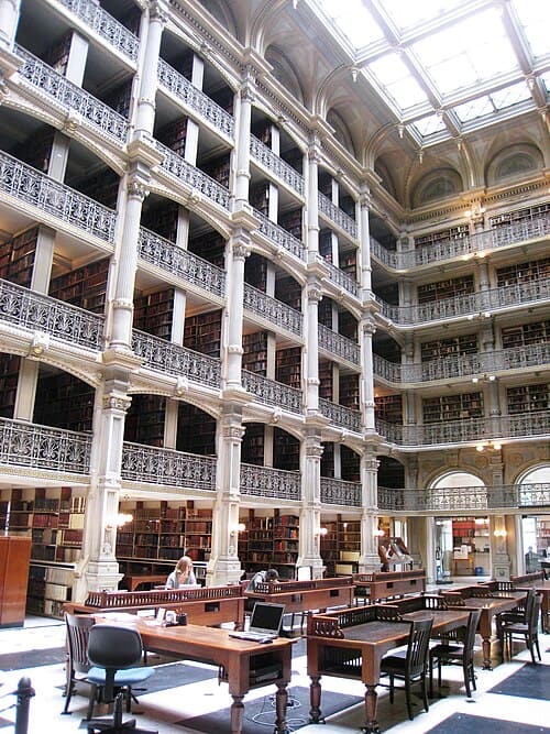
One of Baltimore’s signature interiors and a strong visual anchor for the Mount Vernon section of the page.
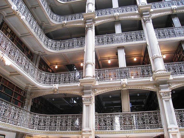
A second view that helps keep the Baltimore page tied to interior access and monumental civic space.
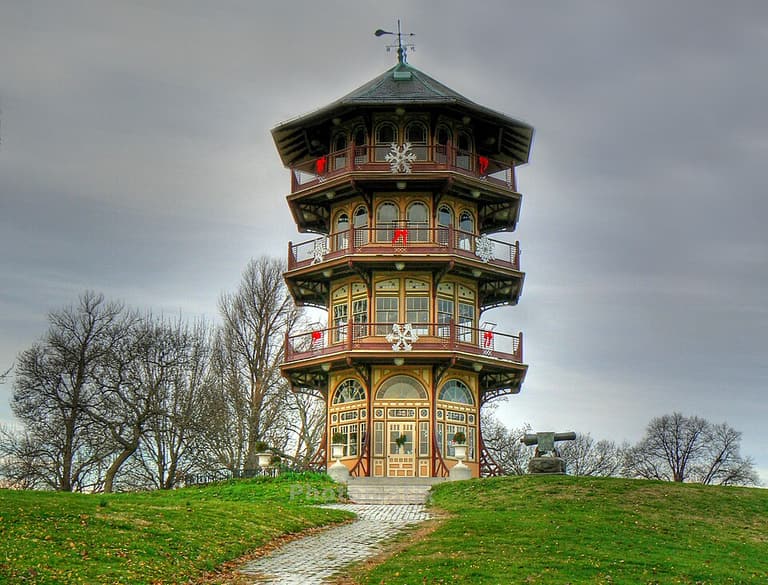
A distinctive observation structure that matches the page’s emphasis on viewpoints and unusual city landmarks.
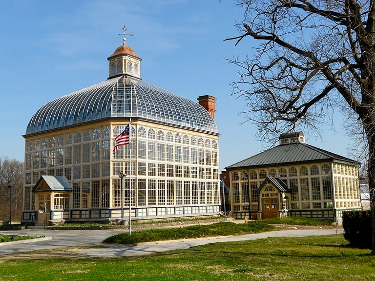
A glasshouse reference that broadens the Baltimore page beyond rowhouses and industrial districts.
Starting Resources
Research Base
The strongest practical starting point for on-foot study, neighborhood reading, and building-level discovery.
Preservation
The official district-level backbone for understanding boundaries, preservation framing, and city-recognized historic areas.
Reference
The strongest route into architect biographies, research pathways, and archival connections specific to Baltimore and Maryland.
Access
Useful when the goal is not just street study, but actual entry into buildings, archives, and event-based interiors.
What Baltimore Does Best
Rowhouses are the city’s repeating unit and core architectural DNA, from early waterfront houses to Italianate, Victorian, and later variations.
Mount Vernon compresses monuments, churches, libraries, museums, and formal urban composition into one unusually rich study zone.
Woodberry and Brick Hill make it possible to study mills, workers’ housing, terrain, and adaptive reuse together.
Baltimore is strong in ordinary and semi-ordinary commercial urbanism, especially when paired with observatories and skyline-view platforms.
Priority Districts
The highest-density architecture study zone in the city for monuments, museums, churches, libraries, and elite urban fabric.
The strongest zone for early brick rowhouses, maritime streets, narrow lots, and long-arc rowhouse study.
The best industrial landscape pairing in the city for mills, workers’ housing, topography, and adaptive reuse.
Best for everyday commercial urbanism, post-fire rebuilding, rowhouse shops, Victorian stores, and commercial façade rhythm.
Best for city-form reading, elevated observation, and architecture as a way of seeing Baltimore rather than only cataloging buildings.
Useful for upper-tier residential Baltimore, prestigious rowhouse blocks, mansions, churches, and later-19th-century streetscape comparison.
Field Routes
Mount Vernon, Fells Point, Woodberry / Brick Hill, downtown commercial corridors, and a final skyline viewpoint make the strongest compressed route.
Use Mount Vernon for monuments and interiors, then Fells Point to Upper Fells Point for maritime fabric, early rowhouses, and Phoenix Shot Tower as an industrial object stop.
Woodberry / Brick Hill / Rawlings works for mills and conservatory architecture, while downtown commercial corridors and skyline viewpoints finish the city-form read.
Open Assets
Reusable Media
The fastest publicly reachable image layer, with file-level license review still required for Wikimedia and photo-page verification still required for Baltimore Heritage.
Documentation
The strongest source for measured drawings, large-format photos, written histories, and serious documentation.
Research Data
Best for maps, district boundaries, and survey-style property records rather than image-led browsing.
Access Notes
Useful for moving from research into actual visits, especially when Baltimore’s best sites have schedule constraints or guided-only entry.